• Welcome to the DeeperBlue.com Forums, the largest online community dedicated to Freediving, Scuba Diving and Spearfishing. To gain full access to the DeeperBlue.com Forums you must register for a free account. As a registered member you will be able to:

    • Join over 47,943+ fellow diving enthusiasts from around the world on this forum
    • Participate in and browse from over 531,990+ posts.
    • Communicate privately with other divers from around the world.
    • Post your own photos or view from 7,455+ user submitted images.
    • All this and much more...

    You can gain access to all this absolutely free when you register for an account, so sign up today!

Bathymetry Maps?

Thread Status: Hello , There was no answer in this thread for more than 90 days.
It can take a long time to get an up-to-date response or contact with relevant users.

Have Blue

New Member
Dec 13, 2007
15
0
0
Hi
I'm new to Spearfishing and am interedted in finding good places to hunt. However without getting into the water with decent visibility I cannot find the reefs / rocks where the fish will live. :head

I could go to a beach and find nothing but a barren sandy wasteland, BUT if I had continued to swim out a further xx metres I may find a lovely reef!

This is a massive stab in the dark but are there any bathymetry (like topography but for underwater) maps for shallow / coastal water?? I guess fishing boats would have such information (although sonar would do the job).

Basically I would love to sit here at my desk and plot interesting places to go explore but I think that would be a bit too good to be true as the data would have to be on such a scale that it would not be feasable. :confused:

Do such maps exist??
 
Go to any chandlery and buy the Admiralty Chart for your area, will show you the depths and reefs in plenty of detail for your needs.
 
Check out the South Devon post for the last couple of years. There is so much imformation to be found in there for this area. I have used it myself to find places to go around here.
 
The Marine Chart or Amiralty chart is the best but may be a bit pricey you could also look for spots using google earth not sure how it will go for Devon but around my area in australia the google images are good enough to see deeper andshallower areas of water to get an idea of location of holes and Bombies etc that are of interest to divers or spearos.
Peter
 
Google earth is a bit hit and miss around the UK, Multimap.com is pretty decent at giving a close up, I use it quite often for picking possible shore marks
 
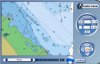
Well as luck would have it, just been posted on another forum. Here's an online chart service free of charge. You will need to register but it's free and better than nothing
 

Attachments

  • cmap.jpg
    cmap.jpg
    94.7 KB · Views: 254
Last edited:
DeeperBlue.com - The Worlds Largest Community Dedicated To Freediving, Scuba Diving and Spearfishing

ABOUT US

ISSN 1469-865X | Copyright © 1996 - 2026 DeeperBlue Global Media Limited.

DeeperBlue.com is an independent digital media platform dedicated to Scuba Diving, Freediving, Ocean Advocacy, and Dive Travel.

Since 1996, we’ve been informing, educating, and inspiring the global diving community through trusted news, features, and shared community experience.

ADVERT