• Welcome to the DeeperBlue.com Forums, the largest online community dedicated to Freediving, Scuba Diving and Spearfishing. To gain full access to the DeeperBlue.com Forums you must register for a free account. As a registered member you will be able to:

    • Join over 47,943+ fellow diving enthusiasts from around the world on this forum
    • Participate in and browse from over 531,990+ posts.
    • Communicate privately with other divers from around the world.
    • Post your own photos or view from 7,455+ user submitted images.
    • All this and much more...

    You can gain access to all this absolutely free when you register for an account, so sign up today!

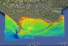
DORset Integrated Seabed study (DORIS) map

Thread Status: Hello , There was no answer in this thread for more than 90 days.
It can take a long time to get an up-to-date response or contact with relevant users.

stevenevenage

Active Member
Jul 5, 2010
8
2
38
I came across this the other day and wanted to share.

The Dorset Wildlife Trust commissioned a seabed survey from the West side of Portland to Swanage bay. All of the sonar images can be viewed in Google Earth. It shows the relief of the seabed, depth and some cross-sectional pictures from divers. It even has diver reports and shipwrecks marked on it. I reckon it could be useful for Planning dives, or recording what you caught and where.

To view the Doris map you first need Google Earth on your computer.
Then open the map in google earth and your set to go.

Let me know how you get on with it.
 

Attachments

  • DORIS-whole-area-map.jpg
    DORIS-whole-area-map.jpg
    60 KB · Views: 561
  • Like
Reactions: Spiderman and Mr. X
I came across this the other day and wanted to share.

The Dorset Wildlife Trust commissioned a seabed survey from the West side of Portland to Swanage bay. All of the sonar images can be viewed in Google Earth. It shows the relief of the seabed, depth and some cross-sectional pictures from divers. It even has diver reports and shipwrecks marked on it. I reckon it could be useful for Planning dives, or recording what you caught and where.

To view the Doris map you first need Google Earth on your computer.
Then open the map in google earth and your set to go.

Let me know how you get on with it.


Very helpful - thanks mate!


.
 
DeeperBlue.com - The Worlds Largest Community Dedicated To Freediving, Scuba Diving and Spearfishing

ABOUT US

ISSN 1469-865X | Copyright © 1996 - 2026 DeeperBlue Global Media Limited.

DeeperBlue.com is an independent digital media platform dedicated to Scuba Diving, Freediving, Ocean Advocacy, and Dive Travel.

Since 1996, we’ve been informing, educating, and inspiring the global diving community through trusted news, features, and shared community experience.

ADVERT