Afternoon everyone,
Firstly, apologies for the chaps reference, won't happen again I can assure you.
Secondly, Dave I would like to respond to some of the questions you raised in your last post. This may take some time, so please bear with me, perservere and read on....
From the Ecological Network Guidance (ENG) that has been released by Natural England and Joint Nature Conservation Committee, reference sites will have to be recommended. These are sites that do not allow any extraction, deposition or human-derived disturbance. Scientists monitoring any MCZs that are designated will be able to compare them with a reference site, information that will be crucial when the MCZs are reviewed every 6 years.
It is likely that reference sites would affect spear fishers. However, it is also likely that these sites will be very small and situated within an MCZ containing the same features. The ENG states that: “for each broad-scale habitat and habitat feature of conservation importance, there should be at least one viable reference area within each of the four MCZ project areas.”
At present we haven’t had the full guidance from NE and JNCC on how they will clarify the different levels of protection that the Regional Projects can propose for each site they recommend. Due to the difficulty of getting our Steering Group to agree to a site without knowing what would or would not be restricted, Louise, our MPA Planner, has begun to put together an interim document regarding what we think the protection levels will be for them to use.
Therefore, in addition to reference sites, our Steering Group will also be looking at the following 3 protection levels:
1. Sea Floor Protection – no activities that impact the sea floor significantly, e.g. no anchoring, benthic trawls etc.
2. Water Column Protection – activities that affect aggregations of mobile species or anything else living in the water column, i.e. no netting, longlining, pelagic trawls, angling
3. Other – e.g. seasonal restrictions, minimum distances from seal haul beaches etc.
There is no set number of sites that will have to be designated, although there are minimum sizes for sites and minimum distances between sites recommended again in the ENG (can be accessed here or for our summary version follow this link, then look under Steering Group, Process Report). The minimum distances will also take existing MPAs into account, such as Lundy, Skomer and the Special Areas of Conservation.
We will be releasing the first iteration of sites to the public after the June Steering Group meeting - all maps will be available on our website, and I will endeavour to post the link on here when all are uploaded.
I hope this helps to answer some of your questions. I think things will begin to really come into focus in July when the national Science Advisory Panel have commented on the first iteration of sites from the Steering Group, we will then know how many of the targets we have met and how many we still need to work towards.
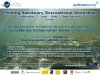
Finally we will be holding a workshop on June 23rd for any Recreational sea users to come and see the data we have collected thus far, feedback their thoughts, concerns to their Steering Group members (I spoke to Dave T earlier today, and he's confirmed he'll be there) and finally, an opportunity to see first hand the maps that were sent off to the Science Advisory Panel. Did I mention the cream tea? See attached flyer for more details.
Kind regards,
Sarah
Firstly, apologies for the chaps reference, won't happen again I can assure you.
Secondly, Dave I would like to respond to some of the questions you raised in your last post. This may take some time, so please bear with me, perservere and read on....
I was wondering if you could give us some indication as to how the information gathered relates to the proposed level of protection for a given site.
Does it work something like, a bass nursery= no take zone, environmentally sensitive sea bed= no bottom trawling but recreational use allowed? Just guessing here to try and get some idea of what might be involved.
From the Ecological Network Guidance (ENG) that has been released by Natural England and Joint Nature Conservation Committee, reference sites will have to be recommended. These are sites that do not allow any extraction, deposition or human-derived disturbance. Scientists monitoring any MCZs that are designated will be able to compare them with a reference site, information that will be crucial when the MCZs are reviewed every 6 years.
It is likely that reference sites would affect spear fishers. However, it is also likely that these sites will be very small and situated within an MCZ containing the same features. The ENG states that: “for each broad-scale habitat and habitat feature of conservation importance, there should be at least one viable reference area within each of the four MCZ project areas.”
At present we haven’t had the full guidance from NE and JNCC on how they will clarify the different levels of protection that the Regional Projects can propose for each site they recommend. Due to the difficulty of getting our Steering Group to agree to a site without knowing what would or would not be restricted, Louise, our MPA Planner, has begun to put together an interim document regarding what we think the protection levels will be for them to use.
Therefore, in addition to reference sites, our Steering Group will also be looking at the following 3 protection levels:
1. Sea Floor Protection – no activities that impact the sea floor significantly, e.g. no anchoring, benthic trawls etc.
2. Water Column Protection – activities that affect aggregations of mobile species or anything else living in the water column, i.e. no netting, longlining, pelagic trawls, angling
3. Other – e.g. seasonal restrictions, minimum distances from seal haul beaches etc.
My knowledge of marine reserves in the UK is limited to scuba diving around Lundy, undeniably a conservation success. Is there a proposed number of such similar sites, and if so, do we know where they are to be sited?
There is no set number of sites that will have to be designated, although there are minimum sizes for sites and minimum distances between sites recommended again in the ENG (can be accessed here or for our summary version follow this link, then look under Steering Group, Process Report). The minimum distances will also take existing MPAs into account, such as Lundy, Skomer and the Special Areas of Conservation.
We will be releasing the first iteration of sites to the public after the June Steering Group meeting - all maps will be available on our website, and I will endeavour to post the link on here when all are uploaded.
I hope this helps to answer some of your questions. I think things will begin to really come into focus in July when the national Science Advisory Panel have commented on the first iteration of sites from the Steering Group, we will then know how many of the targets we have met and how many we still need to work towards.
Finally we will be holding a workshop on June 23rd for any Recreational sea users to come and see the data we have collected thus far, feedback their thoughts, concerns to their Steering Group members (I spoke to Dave T earlier today, and he's confirmed he'll be there) and finally, an opportunity to see first hand the maps that were sent off to the Science Advisory Panel. Did I mention the cream tea? See attached flyer for more details.
Kind regards,
Sarah